


Metsä Group tests drones in drawing up forest plans
Not only do drones, or quadcopters, provide Metsä Group with more precise forest asset data, they uncover the damage done by European spruce bark beetles before it is visible to the human eye. These new methods can revolutionise forest planning.
In the summer 2017, Metsä Group will be testing three new kinds of forest measurement methods. Tests employ drones or, in other words, remote-controlled quadcopters. The aim is to develop new methods for drawing up forest plans, for example.
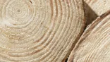
The methods that will be tested will provide Metsä Group more detailed information about forests than what there is in the Metsään.fi service, for instance. Metsä Group has found a method which gives access to detailed information about an individual tree – up to the determination of its species.
A 50–500 hectare property scanned during a single flight
Two methods will be tested in terms of the measurement of forest assets. In cooperation with the company MosaicMill, Metsä Group is developing a method in which the drone flies over a forest property and the trees are measured with the help of digital image interpretation. In the future, the measured data would be transmitted to an application located in a cloud service which would produce a complete forest plan. A single flight allows for the measurement of a 50–100 hectare property. Given that the batteries of quadcopters are continually developing, future flight times will be longer than they are today.
The same method will also be tested with another company, but using a fixed-wing drone instead. Its flight time is longer and allows for measuring a property of approximately 500 hectares in a single flight. This method measures the forest with a laser scanner. The method will be tested in cooperation with Finsilva.
Discovering imminent European spruce bark beetle damage beforehand
In cooperation with Tieto, Metsä Group is testing a method which allows for the detection of spruce bark beetle damage before it is visible to the human eye. The equipment carried by the drone detects trees whose liquid circulation has been disturbed. The aim is to fell damaged trees before the log part is contaminated and changes into pulpwood of a lesser value.
Metsä Group has been developing various drone methods since winter 2016. The previous test results have been good and it is now time for further development. The new methods can revolutionise the entire process by which forest plans are made.
The new methods will lower the costs of drawing up forest plans in the future, and the information concerning a forest property will be more accurate. In the future, you could watch a drone video of the forest property you're about to buy. Virtual 3D forest plans will also become possible further down the road.